 |
||||||||||||||||||||
NSF Program Announcement Research Activities MARGINS-NSF Awards Event Response Policy Data Policy Data Server Post-Doctoral Fellowships Related Websites
|
||||||||||||||||||||
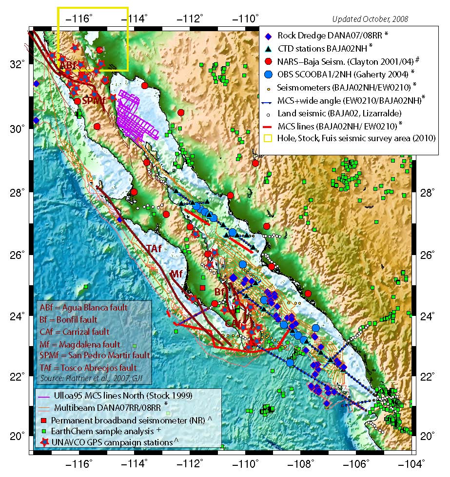
RCL Focus Site: Gulf of California - Salton Trough
This page is the home for data, figures, references and information relevant to the Rupturing of Continental Lithosphere (RCL) Initiative and Gulf of California/Salton Trough focus area. If you have questions, suggestions, or if you want to submit data, please contact the MARGINS Office, who will be happy to try to help you.
Recent News
RCL Paper in Nature: "Variation in styles of rifting in the Gulf of California", Nature 448, 466-469 (26 July 2007). New publication presenting a major result from the MARGINS-funded PESCADOR Gulf of California cruises.
Legal information for scientists planning field work or oceanographic cruises in Mexican territory
This document provides legal information on the correct legal procedure to prepare fieldwork or oceanographic cruises in Mexican terrirtory. All MARGINS scientists planning to work in Mexico are strongly encouraged to study this document carefully.
Data repository web site:
Space Geodetic Velocity Field for Western North America
The Western US Cordillera (WUSC) Deformation Project at the Harvard-Smithsonian Center for Astrophysics works to determine the full spectrum of crustal deformations associated with active geodynamic processes in the western United States by linking existing geodetic networks throughout this diffusely deforming continental region. The project maintains a web site from which investigators can download crustal velocity data from all over North America, including sites in the Northern Gulf of California.